
Itinerary, description of stages, practical informations, accomodation, GPS tracks of Via Mosana from Aachen to Namur.
Via Mosana from Aachen to Namur
Overall, a well marked route. You will see Saint James shells regularly. Beautiful way most of the part off-road without difficulties and without supply problems. Via Mosana is an excellent warm-up for the future.
Websites for Belgium :
Website of “Les amis de Saint Jacques en Belgique” with adresses of families for accomodation : http://www.st-jacques.be/
The guidebook of Saint James ways in the province of Namur in pdf and downloadable online is well done with maps and tourist information.
Tales and pictures of the Via Mosana
Maps on the web :
Germany (province of North Rhine – Westphalia) in english and in german : maps, way paths, distance : http://www.tim-online.nrw.de
Belgium (site de l’Institut Géographique National) in french or in flemish : http://www.ngi.be/topomapviewer/public?lang=fr . Apple Application similar to Geoportail with belgium maps : http://www.sitytrail.com . It is possible to register your route. You will find mine on the name Via Mosana
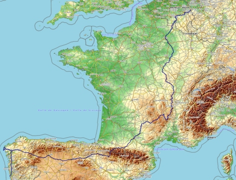
My way from Aachen to Santiago
Linked with the image below : the GPS track of all the hike (this GPS track has been remade after the hike)
My daily stages
| 1 | |
| 23km | Stage profile : Slowly going up to the belgium border (just half an hour from the youth hostel) then down the Gueule. Straight up to Henri Chapelle then lightly down Clermont. The 23 km are straight from the cathedral to Clermont by the way. From Aachen youth hostel, it will be 22km. I walked 5h30 from the YH with some stops. |
| 6h | Note : The path is on the roadside at the exit of Henri Chapelle but otherwise alternating lanes and small roads. |
| Logistic : bars and restaurants in Moresnet Chapelle. Then the path avoids the villages and therefore does not pass directly in front of shops. Bar-restaurant Le Renouveau (closed on Tuesday – wifi) in the center of Clermont Berwinne: walloon friendliness and good food! Accommodation is possible at the presbytery (25 € per night with breakfast): contact Ms. Brandt (14 rue Tribezone) at 087 44 68 22 or jacquesbrandt@voo.be |
|
| 2 | Clermont sur Berwinne – Liège |
| 28km | Stage profile : just 1km after Clermont, you reach on the Ravel (former railway line). Then 12km very easy on the Ravel. After Micheroux, the path goes through nice hills in Evegnée and Sur Miermont. Steep Descent to Jupille before an urban part until Liège |
| 7h | Note : On the Ravel, you can fastly and easily walk. The end of the stage, the way if often by the roadside and in urban areas. |
| Logistic : Shops all the day : in Thimister leaving the Ravel, in Hervé (boulangerie 100m from the railway station), in Micheroux… | |
| 3 | |
| 39km | Stage profile : Steep way up after Angleur. The path can be abrupt, slippery and muddy (sometimes, it’s raining in Belgium…). Steep way down to Esneux. Then, long way up and small hills until Saint Séverin. Goods shoes recommended when it is raining. |
| 9h | Note : 39km from Liege center (Saint Lambert square). I advice to stop for the night in Esneux or to shorten the stage going after la Roche aux Faucons by Plainevaux, le bois de Rotheux, le bois de la Porte et le bois des Moges. Otherwise, it is a nice stage with a path in the woods most of the day. |
| Logistic : Shops in the city center of Angleur. Small market every friday. In Saint Séverin, accomodation in the presbytery : 5€ mat on the ground, shower, kitchen. No shop | |
| 4 | Saint Séverin en Condroz – Huy |
| 21km | Stage profile : I followed the advice on Radiocamino website : via Amay (but without going to Amay center) but I missed the path and went through Magotte. Rapid descent to Hermalle and then steep ascent. Otherwise, mostly flat in the hills and the woods. |
| 4h30 | Note : It’s 1 km more to Huy city centre. Following the GR in Hermalle wood, I went to Magotte (Hermalle township). Ascent through a kind of small path ahead from Ombret-Rawsa. Nice stage in the woods with almost no road. Sometimes, it is not easy to find the path. |
| Logistic : you will find everything in Huy. Very nice accomodation in the gorgeous castle-farm above Huy : Château de la Sauvenière sauvenieresarte@gmail.com 085/21 10 52 – 25€ with breakfast (sometimes full because occupied by seasonal workers) – wifi | |
| 5 | Huy – Andenne |
| 20km | Stage profile : steep way up after Huy. Then nicely way on the hills before joining the Meuse valley at the point where the Rau river reach it. |
| 4h45 | Note : Again a very beautiful stage especially the part along the Solières river. Then, small and unbusy asfalted roads to join the Ravel. After Solières, I sometimes wandered to find my way. My GPS route is on Geolives |
| Logistic : in the countryside from Huy to Andenelle the stage is short… | |
| 6 | Andenne – Namur |
| 27km | Stage profile : on the right bank of the Meuse via Bonneville, Thon et Mozet. Light ascent at the beginning after Saint Roch. Steep way down then up in the Samson valley. |
| 6h | Note : 27km until Namur youth hostel. It is 2km less to Namur center. Way alternanting paths and small roads. Very beautiful village of Bonneville, Thon et Mozet. You reach Namur staying in the countryside until the arrival near the Cité du Souvenir by the Meuse. |
| Logistic : Grossery in the Samson valley at the bottom of Thon. Boulangerie snack in Erpent. Both are closed on monday. Hypermarket Carrefour arriving at the Meuse valley. Very nice youth hostel in Namur. Renovated, old and beautiful house along the Meuse, very nice people, dorms with shower (20€ with breakfast) – wifi | |

Thank you for this great description, in English, of a route which I am planning to walk later in 2014.
I am hoping to walk the Via Mosana in May. Can you tell me, is it necessary to book over night accommodations far in advance or can you book 24 hours in advance? Thank you. Bruce brucewquick@gmail.com
It’s a very lonely way. You won’t meet hikers especially in may. But as there are few places for sleeping (ex with families), it’s better to call few days in advance to know if it’s possible.
Doing the Via Mosana in pieces. Just walked from Liege through to Nandrin ( May23rd ) and used booking dot com to stay at La Ferme de Sotrez. Fabulous place to stay. In June I’ll continue thru Huy to Sclaigneux. The path is overgrown in several places especially next to the river and thru the forests there’s a lot of washing out making going a little slow in places.